At Murphy Surveys we are accustomed to clients asking for a wide variety of deliverables when it comes to their surveying needs. Whether it’s different types of software outputs or customised surveys, we invariably have the answer.
Over the past year the pace of BIM adoption by Irish companies has increased to such an extent that we often get asked ‘Can we do that in BIM?’ Our aim is to make it a resounding ‘Yes’ and this year has certainly been a journey of constant improvement and evolution for Murphy Surveys as BIM grows in Ireland.
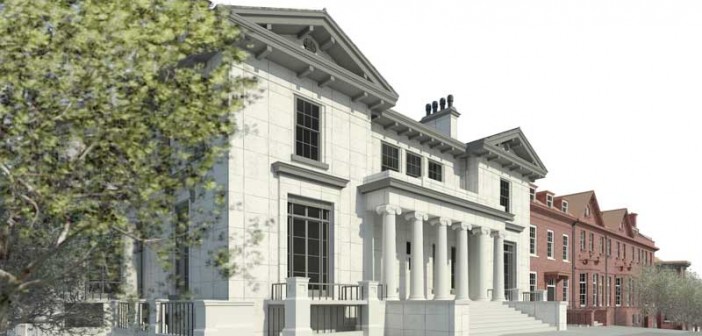
We have delivered projects across heritage, commercial, industrial and healthcare sectors to name but a few over the past 12 months. Particular achievements include a recent BIM project for St Vincent’s Hospital Campus, as well as other major healthcare and ‘city block’ type redevelopments which required BIM deliverables of numerous buildings, services and site topographies in single files.
Other projects involve complete modelling of architectural, services and temporary structures. A current project at a major airport in the UK requires a high level of detail and accuracy including all fittings, wiring and sockets while including customised meta data and COBie outputs for FM software use and maintenance uses.
This year we have noticed that clients are becoming much more specific in communicating why they want BIM and for what outputs it is to be used downstream and are much more open to collaboration as a result. This greatly helped our modelling team deliver BIM projects successfully.
Scan to BIM
Improvements year on year in software vendor capabilities have brought about increased speed and quality in the ‘Scan to BIM’ processes. Murphy Surveys have built on previous expertise in the area of laser scanning and processing to provide multiple solutions to meet our clients’ needs. High quality laser scans on site enable models to be produced in a variety of ways from solid, wireframe, 2D and 3D CAD to BIM models. Sections can be produced directly from laser scans for immediate information while more in depth information and data can be attained through full Revit model production. Even drawing within the point cloud itself while simultaneously creating CAD information in real time is now a possibility too, reducing duplication while increasing speed and ensuring ultra-accurate measurements for onsite queries. All this has been made available over a short space of time.
Murphy Surveys can produce Revit models that highlight deviations and tolerances from laser scan point clouds and for an even better Quality Assurance procedure in a ‘Scan to BIM’ process, models can be verified automatically against point cloud data to show object deviations from scans. Such a process removes human error and dramatically increases reliability and speed of verification, particularly in a project which is on site requiring frequent scans to verify position and control of items as it progresses.
Field to BIM to Field
‘Field to BIM’ has also seen changes in the past year. We can now bring models and data onto site through mobile platforms more easily so that we can verify construction on site in real time. We can also make changes to model items due to site conditions simultaneously; whether it is through dedicated tablets or readily available consumer tablets, there is now a much better choice. Poor internet connectivity on site is also much less of a problem now as caching within a device allows temporary storage of relevant data until network connectivity is resumed wherever that may be. Such advantages have widened our ability to make surveying data a truly mobile and real time process.
An evolving process
Over the past year our clients have asked for different things on every BIM survey project we have been involved in. Client feedback has tailored how we do BIM and enables us to refine our own processes and to incorporate new and innovative approaches that we may use to meet a client’s need, even when they may not be aware of such approaches. It is only by researching and testing new technologies that we can offer these alternatives.
In particular this year, we have seen a sharp increase in surveys requiring Measured Buildings, Services and Site Topographies to be combined in a model file. While the requests have increased, many have still to understand how this surface works and its interactions with objects. However, working around this has brought its own innovations in relation to how we deliver the required information and has resulted in us exploring many softwares.
Producing topographic surfaces in model files using default methods can produce inconsistent results. This is not down to actual errors, but to the way points are created from imported information and planes created. Understanding how topographic surfaces work and how to improve the incoming data and the process itself can result in superior topographies that surpass all expectations. This allows engineers and utilities personnel to more easily analyse sites while extracting relevant data. It also allows better contextual site information to be displayed in relation to other structures.
Murphy’s are proud of such improvements and innovations and will strive as ever to do so over the next 12 months and beyond.


