Leica Geosystems went back on the road in June for the Irish leg of their roadshow tour. Prior to this, Leica Geosystems toured the UK in May starting in Aberdeen and Cambridge and finishing in Milton Keynes.
Set in the beautiful surroundings of Galgorm Spa and Resort, Ballymena, this was the first stop of the Irish roadshows, a perfect location for Leica’s technical demonstrations.
The focus of their roadshows this year was specifically on digital realities – bringing the real world into the digital world and what this means to us as geospatial professionals. Digital reality isn’t something that can be ignored and digital technology has an effect on our everyday lives.
Digital disruption refers to changes enabled by digital technologies. It is happening all around us all of the time. Think about a mobile phone, phone calls are not the primary reason for a mobile phone, it has so many other functions. Soon driving will not be the primary function for a car, we now have active assist helping with self-parking and cruise control.
Leica Geosystems plays a big part in creating the digital world. With Mobile Reality Capture Solutions, like our Pegasus 2, we create Digital Streets with car mounted LiDAR and Imaging technology capturing all asset information on the roads around us. The Pegasus 2 mobile mapping system delivers workflows that allows us to track every single detail on the street bringing a whole new world to dynamic mapping.
To find out more about the Pegasus 2 and mobile mapping, please click here http://leica-geosystems.com/products/mobile-sensor-platforms
As well as mobile mapping, maintaining assets and adding new data or maintaining asset information to include attributes and metadata is also a prerequisite to maintaining the digital world. This is where the Zeno20 comes into place, putting high accuracy geospatial information in the hands of field workers. It gives ultimate flexibility for field data management with a choice of software and workflow. The Zeno20 has scalable accuracy options and is the first high accuracy handheld device based on the android operating system. As easy to use as your smartphone, you can collect data faster, therefore reducing costs.
To find out more about the Zeno 20 please click here http://leica-geosystems.com/products/gis-collectors/gis-handhelds-tablets
Volume data capture is not always possible by vehicle. At the roadshows Leica Geosystems also shared their insights into the Pegasus Backpack, allowing the greatest mobility inside and outside. The Pegasus backpack was also the winner of the Wichmann Innovations Award for best innovation, awarded in October 2015. It is the industry’s first wearable reality-capture technology that combines five high-dynamic cameras and two LiDAR profilers within an ultra-light and ergonomic carbon fibre chassis.
To find out more about the Pegasus backpack please click here http://leica-geosystems.com/products/mobile-sensor-platforms/capture-platforms/leica-pegasus-backpack
At each of the roadshows, an in-depth presentation kicked off the start of the day, embellishing on the next stage of the Leica Captivate experience – Leica Captivate version 2. Some of the new features of the Leica Captivate experience discussed at the roadshows are detailed below:
Dynamic prism lock
Leica Geosystems looked at the ability for their MultiStations to lock onto a moving prism. Last year Leica Geosystems introduced ATRplus which gives best ever prism locking performance and now with dynamic lock, the instrument will automatically lock back onto the prism as soon as you reappear from behind the obstruction without the need to put the pole down and initiate a search. Before the introduction of dynamic lock, the prism would have had to be in the field of view of the telescope (+/- 1.5°) in order for the prism to be locked on to. But now we have been able to open up that field of view to +/-20° which allows us to lock to a moving prism, for example on a pole, or on a machine.
GNSS
New members of the GNSS family were also introduced at the 2016 roadshows. The new RTKplus receiver technology already provides impressive availability of accurate positions in difficult environments. With more GNSS signals than ever before, the risk of increased position noise becomes very real. The new Leica Viva GNSS is self-learning thanks to RTKplus and SmartLink.
RTKplus works in locations which were never previously possible. So RTK plus is simply like RTK but better. Its an intelligent use of the signal, its 2 new engines: the measurement engine that tracks the signal, and the RTK engine that processes all the measurements. These 2 engines work in perfect harmony. Leica Geosystems has again pushed the boundaries and again has created another milestone in high precision GNSS.
SmartLink
SmartLink pushes boundaries by increasing centimetre position availability in areas where RTK communication links are unstable. Often UHF radio or the cell phone communication links are interrupted. SmartLink correction service delivered via satellite bridges RTK communication outages for uninterrupted centimetre positioning up to 10 minutes. The accuracy during SmartLink service is slightly reduced compared to an RTK service with an approximate 2D accuracy of ±5cm.
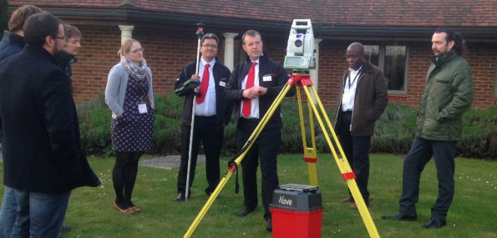
Some outdoor demonstrations also complimented the presentation, where customers were able to see Leica Geosystems’ new products for themselves and ask questions


